Starčevica (Starcevica)
Starčevica (Старчевица) is a neighborhood and a local community in Banja Luka, Republika Srpska, Bosnia and Hercegovina. It is located on the right bank of the river Vrbas, southeast of the city center.
Starčevica as local community started existing on April 27 1978 when officially became a part of the city. Today is one of the biggest local communities of City of Banja Luka with estimated population about 30,000 inhabitants. As every other local community in Banja Luka, Starčevica has its Local Community Council that is elected by 15 123 people and the council has 11 members on 2017 local community elections. All members of council are members of Alliance of Independent Social Democrats.
Starčevica is constituted on 2006 by City Assembly of Banja Luka and territory of local community has streets: Vojvode Stepe Stepanovića (numbers: 89-199 and 62-146), Koste Jarića, Miloša Dujića, Danila Perovića, dr Vojislava Đede Kecmanovića, Josifa Pančića, Vaclava Havleka Vene, Milovana Hrvaćanina, Rajka Bosnića, Save Ljuboje, Kosovke djevojke, Sime Miljuša, Slobodana Dubočanina (former VIII prigradski put), Tuzlanska (numbers: 1-23 and 2-48), Srpskih ustanika, Ognjena Price, Jovana Jančića, Prve krajiške brigade NO, Jug Bogdana, Stevana Bulajića (from house numbers 43 and 122 till the end), Starog Vujadina, Cerska, Majke Jugovića (numbers: 1-21), Milice Stojadinović Srpkinje, Srpskih dobrovoljaca, Visokih Dečana, Manastira Gračanice, Studenička, Saničkih žetelaca and Stevana Prvovjenčanog. Starčevica has borders with local communities Ada, Borik 1, Centar 1, Obilićevo 1, Obilićevo 2, Srpske Toplice and Debeljaci.
Because of a lot of administrative problems Starčevica tends to get status of city municipality for reason of solving its problems that are seeable in education (in Starčevica there is only one school) and other problems. As it was said by former president of the Local Community Council Đorđe Knežević, Starčevica has no green market, sports hall, kindergartens in number that is necessary and only school has much more students than it should be. Increasing of population also makes a problem in this neighborhood because of lack of local institutions that will help to population.
Slava of the local community is Nativity of Mary (September 21 by Eastern Orthodox liturgical calendar).
Map - Starčevica (Starcevica)
Map
Country - Bosnia_and_Herzegovina
 |
 |
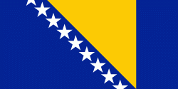
| Flag of Bosnia and Herzegovina | |
The area that is now Bosnia and Herzegovina has been inhabited by humans since at least the Upper Paleolithic, but evidence suggests that during the Neolithic age, permanent human settlements were established, including those that belonged to the Butmir, Kakanj, and Vučedol cultures. After the arrival of the first Indo-Europeans, the area was populated by several Illyrian and Celtic civilizations. Culturally, politically, and socially, the country has a rich and complex history. The ancestors of the South Slavic peoples that populate the area today arrived during the 6th through the 9th century. In the 12th century, the Banate of Bosnia was established; by the 14th century, this had evolved into the Kingdom of Bosnia. In the mid-15th century, it was annexed into the Ottoman Empire, under whose rule it remained until the late 19th century. The Ottomans brought Islam to the region, and altered much of the country's cultural and social outlook.
Currency / Language
| ISO | Currency | Symbol | Significant figures |
|---|---|---|---|
| BAM | Bosnia and Herzegovina convertible mark | KM or КМ | 2 |
| ISO | Language |
|---|---|
| BS | Bosnian language |
| HR | Croatian language |
| SR | Serbian language |


